Follow the steps below to create a MGA94 or MGA2020 geoid to be used as a GPS Localisation in 12d Field.
- Go to the following 12d Wiki page and follow the steps to download the N_Values.zip file which contains tiles of each MGA94 (Ausgeoid 09) and MGA2020 (Ausgeoid 2020) zones broken up into smaller areas (.DAT files) by Geoscience Australia.
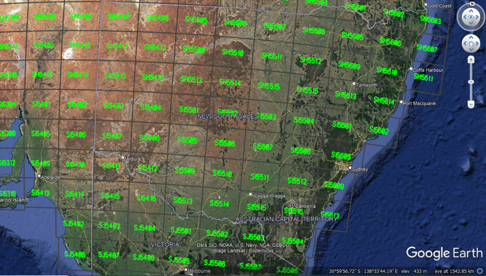
https://12dwiki.com.au/survey-data-reduction-n-values/ - If you are unsure what .DAT file/s to select, please see image below.

Inside 12d Model
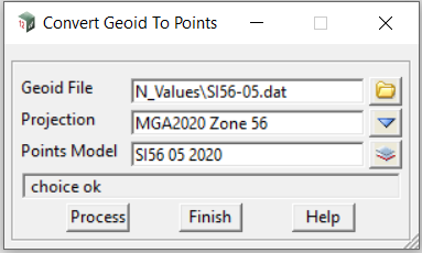
- Inside 12d Model go to Survey => 12d Field => GPS Localisation => Convert geoid to points…This will convert the data in the .DAT file to points in 12d Model.
NOTE: This option is only avaliable in version 15, for version 14 contact EXDS for the macro and follow the step under Troubleshooting Tips at the bottom of this page. MGA 2020 projection will only appear in the later versions of 12d version 14, so please make sure you are using v14c2k.

- Once the points of the geoid are created, it is time to triangulate this model of geoid points. If you are unfamiliar with creating a triangulation (tin) please read the 12d Wiki link below.
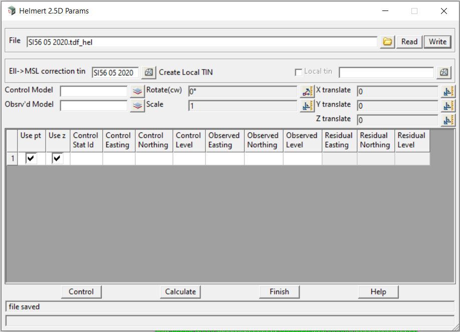
https://12dwiki.com.au/triangulate-data/ - Once the triangulation is created you can now use that in the 12d Field Localisation panel as a Ell->MSL correction (geoid) tin.
Go to Survey => 12d Field => GPS Localisation => GPS Localisation and in the Ell->MSL correction panel select the geoid tin that you have just created by left clicking on the tin icon. - In the GPS Localisation panel go to the top and type in a file name and left click on “Write” to save it.

- When starting up 12d Field make sure you select the correct projection and tick on perform transformation and browse to the newly created GPS localisation file as this is our 12dF Helmert Params file.

Troubleshooting Tips
- If you cannot see the option to convert the .DAT file as you are using version 14 please contact EXDS Support via email support@exds.com.au to recieve the macro (.4do file) that can be used in 12d Model v14 (Utilities => Macros => Run => Run).
- If you cannot see the MGA2020 projection in the list….Upgrade to v14c2k.
- Make sure you select the correct mount point in your manufacturers GNSS settings eg either MGA94 or MGA2020 if you are 1.7m out when checking onto Control Points this could be why
- Make sure you select the correct projection and .DAT files when creating the geoid tin. When in 12d Field if you turn the geoid tin on and your GPS icon if off the tin then this could be why.
- If you are getting 20m or so difference in height this is due to the geoid tin correction not being applied, you will need to go through this post step by step again to check your work.